Country: Afghanistan
Name of Client: GoA
Start date: 22 Feb 2009
Completion date: 15 April 2010
PIMSS has got bellow different modules integrated with each other:
- PIMSS Web Application
- PIMSS Online GIS Application
- PIMSS Mobile Application
- PIMSS & Primavera Integration
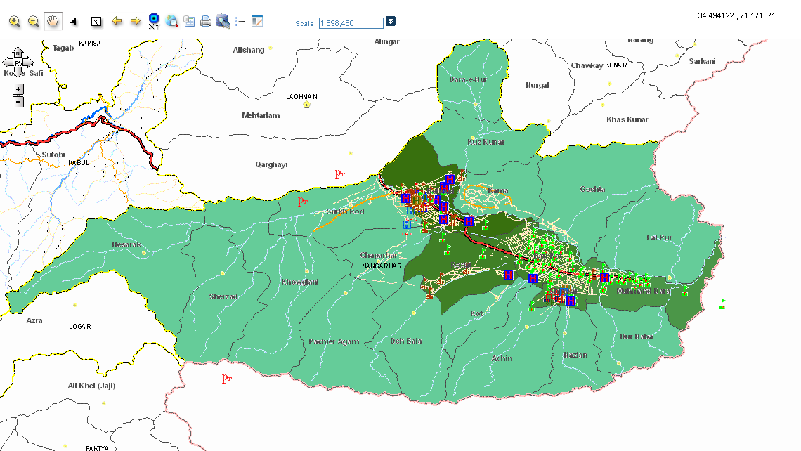
PIMSS Spatial is part of the PIMSS system that integrates PIMSS data with geographical data, thereby enabling the application to view, edit and manage data in an integrated spatial environment. This module uses the geographical coordinate system which provides users with spatial data, allowing the user to view the positions of assets and projects in their exact X and Y coordinates. The module provides the following main features:
- View projects and assets: Projects and assets can be viewed using different symbols based on their type and sector in their exact X and Y coordinates.
- Query data (Assets and Projects): The module provides a set of criteria to query and filter assets and/or projects. It also allows the user to select specific data for further detailed information based on the selected criteria. Additionally, it allows the user to generate statistical and/or analytical data in a graduated map.
- Data insertion: The module facilitates the insertion of asset and project coordinates into the system. This not only eases the insertion process through a one-click action, but also brings more accuracy to the data providing exact X and Y coordinates for the assets and projects and showing their exact position in a map enriched with a back-end imagery layer.
- Linking data: The module allows the user to link assets to projects in the map. Only assets associated with the same sector as the project can be linked to the project.
- Export/Print map: The module provides the application with the functionality to export or print maps with their modified or filtered data in a PDF, JPEG or HTML format.